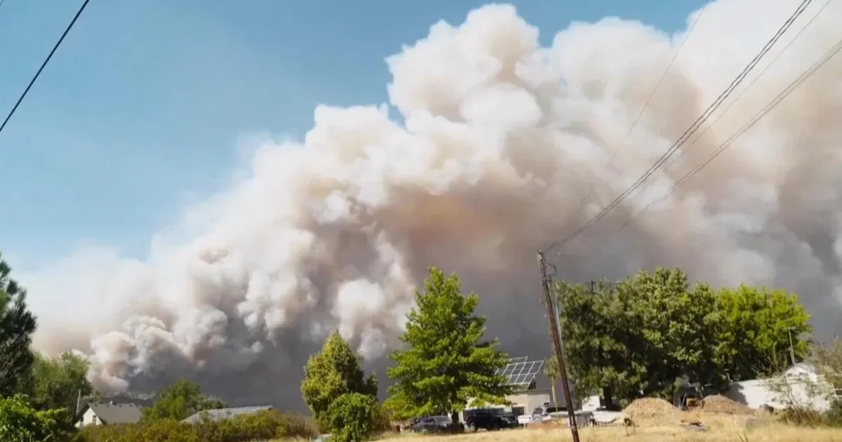
A wind-driven wildfire northwest of Spokane pushed across a river, threatened thousands of structures and forced residents from their homes as Washington moved into a statewide emergency. The Old Trails Fire was the most immediate danger around the state's second-largest city, but it was only one part of a response spanning active fire lines, public facilities, power service and hazardous smoke.
The first evening estimate put the burned area near 3,000 acres—an expanse of about four square miles. The Washington State Department of Natural Resources reported zero containment after flames crossed the Spokane River and advanced toward residential areas. By August 1, 2026, more than 200 evacuations had been ordered and approximately 4,000 structures stood within the threatened area.
Governor Bob Ferguson declared the emergency and announced a statewide burn ban that same day. He said record drought and high winds had created dangerous conditions. The order made more state resources available, allowed agencies to accelerate emergency assistance and left open the deployment of additional National Guard personnel. The burn ban was set to remain in force through September 30.
The Fire Perimeter Reached Beyond Homes
The first incident report came Saturday morning from Spokane's northwestern side. State officials identified three forces behind the quick expansion: intense heat, forceful wind and vegetation dried by exceptional conditions. The maximum local alert, Level 3, applied to sections northwest of the city and near Airway Heights. Its “Leave Now!” wording directed people to move immediately. The agency warned that the boundaries were changing quickly and urged residents to follow current orders rather than rely on an earlier map. Thousands of residents were told to leave as the fire moved toward homes and infrastructure, making the evacuation level a direct instruction rather than a forecast of possible risk.
The evacuation footprint included more than neighborhoods. Spokane Mayor Lisa Brown identified three affected public sites. Evacuations reached the veterans hospital, the city's waste-to-energy operation and a facility that processes reclaimed water. Moving people from those facilities turned the fire into an infrastructure problem as well as a residential emergency: officials had to protect the public while preserving services that a city needs during a prolonged response. The reports confirmed the evacuations but did not say that any of the named facilities had burned, so exposure and confirmed damage remained separate questions.
The available reports did not identify any deaths or injuries. That absence was an important status update, not a measure of the fire's future risk. A blaze with no containment, shifting winds and multiple Level 3 zones could change direction before crews secured its edge. For residents, the practical boundary was therefore the latest official evacuation notice, not the acreage published hours earlier.
Smoke Created a Second Emergency Zone
Communities beyond the evacuation areas faced a different hazard. An air-quality alert carried by the National Weather Service stretched from Spokane and Airway Heights to communities including Colville, Wenatchee and Omak. Smoke from fires in Washington, Oregon and British Columbia was expected to move with changing winds. The alert came from the state Department of Ecology, the Environmental Protection Agency and the Spokane Regional Clean Air Agency, linking the weather warning to agencies responsible for measuring and managing pollution.
The warning focused on fine particles known as PM2.5, which could reach unhealthy concentrations in downwind counties. People were told to spend less time outside, skip heavy exertion and reduce their exposure indoors where possible. That guidance drew a clear distinction: evacuation orders addressed immediate danger from fire, while the smoke alert extended the protective response far outside the flame front.
Power outages added another layer to the disruption, the BBC reported. A household outside an evacuation zone could therefore avoid direct fire danger while still losing electricity or breathing unhealthy air. Those overlapping effects explain why a statewide declaration can be necessary even when the most closely watched blaze is concentrated near one metropolitan area.
Statewide Totals Do Not Replace Local Orders
At the state scale, officials were managing at least 13 major incidents whose active burn areas together exceeded a quarter-million acres. The Kaiser Canyon Fire in northeastern Washington was the largest cited in the reports at about 134,000 acres. The season-wide measure was larger. Dave Upthegrove, the official responsible for Washington's public lands, put the cumulative burned area just below half a million acres. Those figures describe different scopes—active fires, one large incident and the season to date—and should not be combined as if they measured the same thing.
The statewide workforce numbered close to 4,000 firefighters. National Guard personnel and teams sent by other states reinforced them. Ferguson planned to visit the area on Sunday to meet responders and monitor the operation. The emergency proclamation gave that distributed effort a common resource framework, but decisions remained local and time-sensitive. A statewide total could show the pressure on crews; it could not tell a family near Airway Heights whether a road was open or whether a Level 3 boundary had moved.
The next meaningful updates will come from separate measures. For the Old Trails Fire, crews need to report containment, perimeter change and the status of evacuated facilities. Across the wider region, air monitors and wind forecasts will determine how long smoke restrictions remain necessary. Until then, the latest local evacuation map is the decisive public-safety document, while the statewide declaration supplies the personnel and authority behind the response.