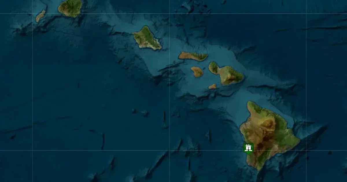
Hawaii residents across the central Pacific reported strong shaking after a magnitude 6.0 earthquake struck the southern coast of the Big Island. USGS instruments recorded the event late Friday evening near Honaunau-Napoopoo. Precise coordinates placed the epicenter approximately eight miles south of the coastal community. The seismic rupture occurred on May 22, 2026, at a depth of 14 miles. Reports of ground movement spanned from the volcanic slopes of Hawaii island to the urban centers of Oahu.
Data from the Pacific Tsunami Warning Center arrived minutes after the initial shock. Officials confirmed that despite the high magnitude, the earthquake did not generate a tsunami threat for the region. Energy from a quake at a 14-mile depth often dissipates differently than shallower offshore events. Vertical displacement of the seafloor, which is a primary driver of tsunamis, was not observed in this instance.
Hawaii island residents nevertheless reported prolonged shaking that lasted several seconds.
The Pacific Tsunami Warning Center reports that there are no tsunami threats at this time.
Coastal communities in the South Kona district bore the brunt of the seismic energy. Local emergency management teams activated protocols to inspect bridges and coastal roadways for structural damage. No immediate reports of significant injuries or major building collapses surfaced in the hours following the strike. Power grids in Hilo and Kona stayed functional despite the intensity of the tremor. Maintenance crews began inspecting high-voltage lines for potential sagging or insulator failures.
Scientists at the USGS Hawaiian Volcano Observatory began immediate assessments of Kilauea volcano. Historical data suggest that large seismic events in the South Kona districts can influence magmatic pressure within neighboring volcanic systems. Monitoring equipment located on the caldera floor and along the East Rift Zone provided real-time telemetry to researchers. No immediate changes in gas emissions or tiltmeter readings were detected.
The observatory focuses on the summit and rift zones for any signs of induced instability.
Magmatic systems under the Big Island are interconnected through a complex network of reservoirs and conduits. Large earthquakes can occasionally act as triggers for subterranean shifts, though such occurrences are not guaranteed. Geologists focused their attention on the Southwest Rift Zone, which sits in closer proximity to the epicenter. The 14-mile depth places the origin of the quake within the brittle oceanic lithosphere. Tensions in this layer often result from the large weight of the volcanic shields pressing down on the Earth's crust.
Seismic Depth and Tsunami Risk Assessment
Residents in Honolulu, located over 180 miles away, reported feeling the quake as a slow, rolling motion. High-rise buildings in the Waikiki district experienced swaying that triggered some automated alarm systems. Security personnel conducted floor-by-floor checks in major hotel towers to ensure guest safety. Local police departments received dozens of calls from concerned citizens but reported no emergency calls related to property destruction. Operations at Honolulu International Airport continued without interruption.
Seismologists noted that the 6.0 magnitude fits within the expected range of periodic stress release for the Hawaiian islands. Major events in 1975 and 2006 previously caused serious damage and altered the local topography. This latest event occurred in a zone known for tectonic flexure rather than direct volcanic eruption. Every few years, the weight of the islands forces the underlying crust to snap or bend.
These movements provide essential data for updating building codes and emergency response plans.
Monitoring Kilauea and Regional Volcanic Shifts
Structural engineers often use these events to test the resilience of newer infrastructure built under modern seismic standards. Comparisons between older masonry structures and steel-reinforced designs reveal how the islands have adapted to persistent geologic threats. Federal agencies and local authorities coordinate throughout the year to refine evacuation routes and communication chains. Early warning systems, though still in developmental stages for the Pacific, play a role in notifying sensitive industries of incoming waves.
Emergency shelters stayed on standby throughout the night as a precaution against strong aftershocks. Small tremors followed the main event, though none exceeded a magnitude of 3.5 in the first two hours. Families in the Kona district reported securing loose items and checking gas lines for leaks. Public safety officials urged citizens to remain vigilant but noted that the immediate crisis had passed. Geologic surveys will continue for several days to map the precise fault line involved in the rupture.
The Quake Tests Hawaii's Warning Systems Without a Tsunami
The seismic event is a critical test for the Big Island emergency management framework and critical infrastructure. While the absence of a tsunami prevents a large-scale coastal catastrophe, the 6.0 magnitude tremor highlights the persistent vulnerability of inland transportation and power networks. Strategic planners must consider how deep lithospheric quakes might interact with active volcanic conduits, particularly at Kilauea. Geologic stress often transfers across fault systems, meaning a single rupture can destabilize neighboring sectors.
Protecting the tourism-heavy economy of Oahu and Maui requires more than structural reinforcement. It demands real-time communication systems that can differentiate between a nuisance tremor and a life-threatening tectonic shift. Emergency protocols in high-density areas like Waikiki must be regularly tested so officials can prevent confusion during prolonged swaying events. The current resilience of the power grid provides some comfort, but a shallower quake could easily sever essential lifelines. Maintaining these systems is a constant requirement for communities built on an active volcanic chain.